Passion Project - City on your Foot
Shape your Walkable & Unique Travel Experience
Timeline
3 Months
Role
Product Designer, Researcher -
user research, design, testing
Tools
Figma / Miro / Notion
Collaborator
1 Product Researcher and 1 UI Designer
Context
In the summer of 2022, over 93 million Americans travelled in US and abroad, relying on navigation apps. Of these, 63% prefer urban areas for their vacations. While tourists often reported misguided and confused with current travel experience.
Then we delve deeper into the scenario:
Imagine you finally escape work and embark on a trip. When you are wandering in a new city, unexpected gaps of time often emerge between your pre-planned tourist spots
01 - Research
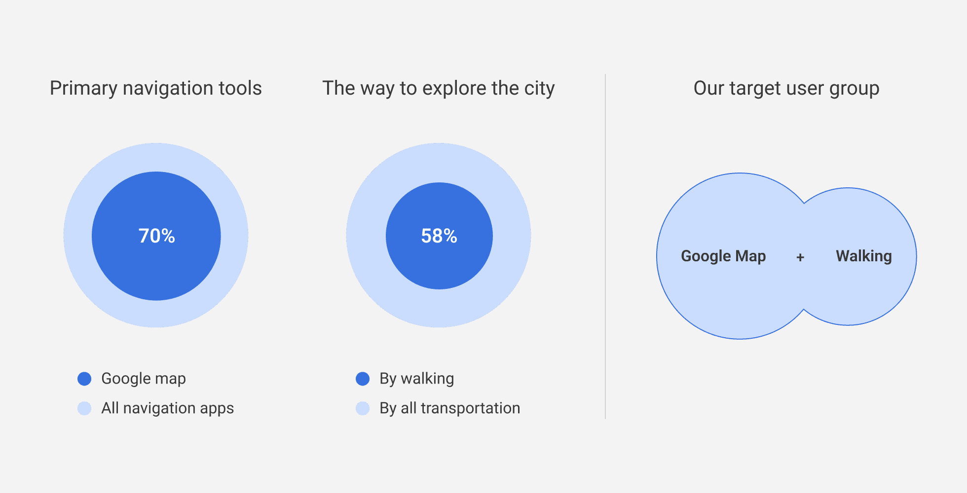
Tourists predominantly explore the city on foot using Google Maps for navigation.
Based on the analysis of 500 survey responses, we've created a representative user profile for tourists traveling in urban areas with two common behaviors: using Google Maps and walking.
Why Google Maps may not be ideal for walking tourists?
After conducting 12 in-depth interviews with selected user groups, we identified two main pain points that hinder walking tourists from exploring the city with ease.

02 - Ideation
Aimed at resolving previous pain points, we visualized some abstract ideas following our discussion:
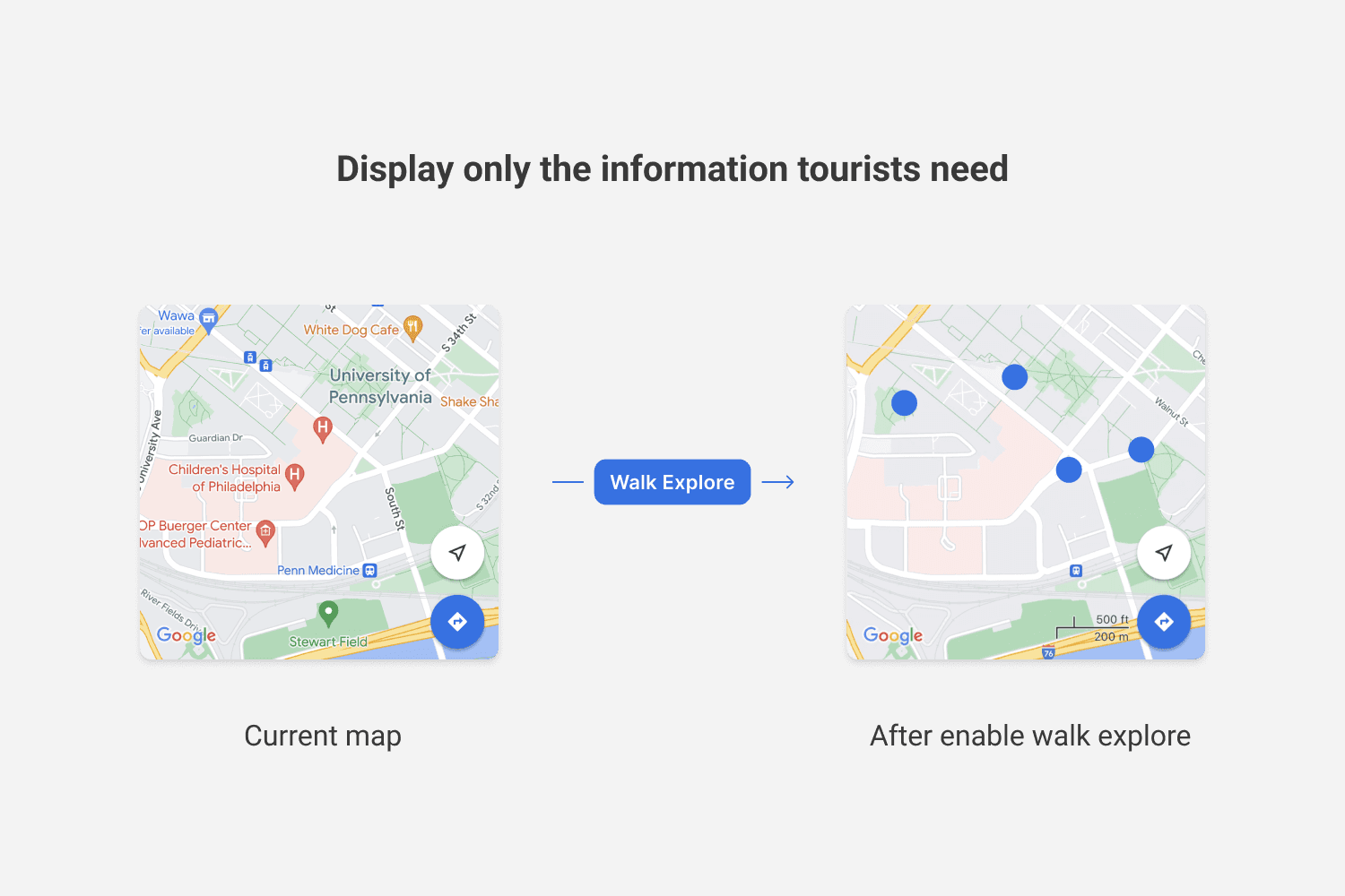
Approach 01 - A display filter that retains only essential information
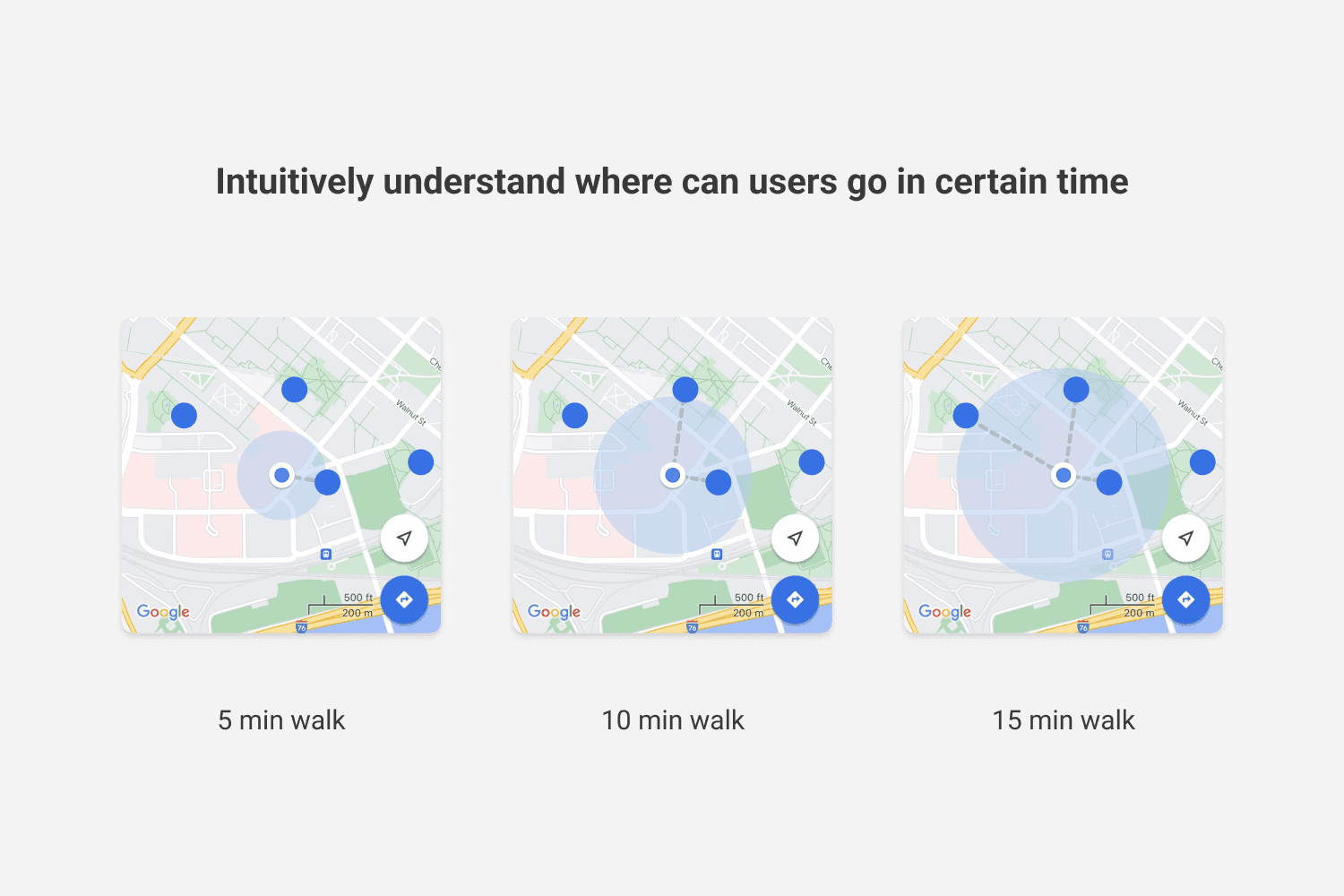
Approach 02 - A walk estimation circle that provides travel destinations based on preset free time
Approach 03 - Provide destination options customized to different cities
03 - Iteration
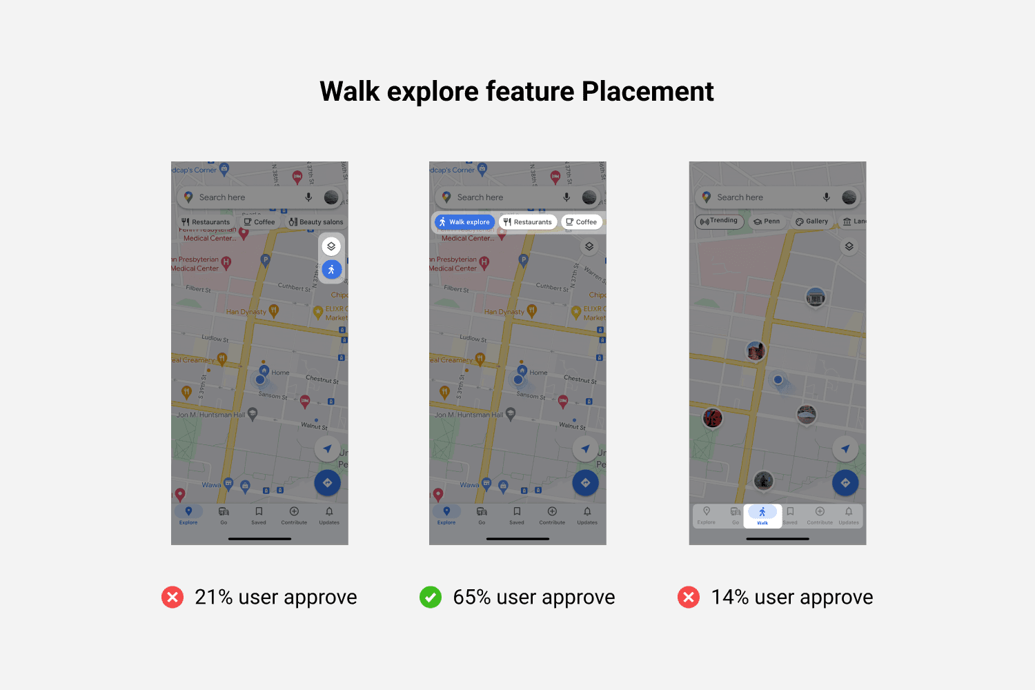
After the initial prototype design, we conducted over 5 rounds of usability testing with our target users to gather feedback. One of the biggest concerns focused on the positioning and hierarchy of the entry point for our newly introduced feature. Another issue was aligning our newly designed feature with the original app's material design style.
/ How is the 'Walk Explore' feature easily accessible to users without disturbing their other daily activities?
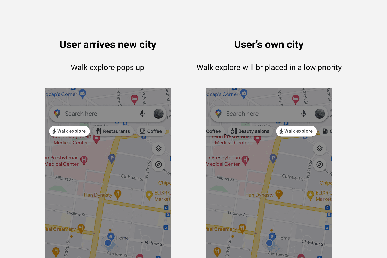
Stage 01 - Define feature priority based on different scenarios
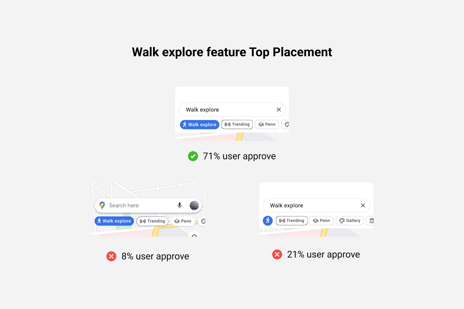
Stage 02 - Entry point placement
Stage 03 - Define feature hierarchy based on scenarios
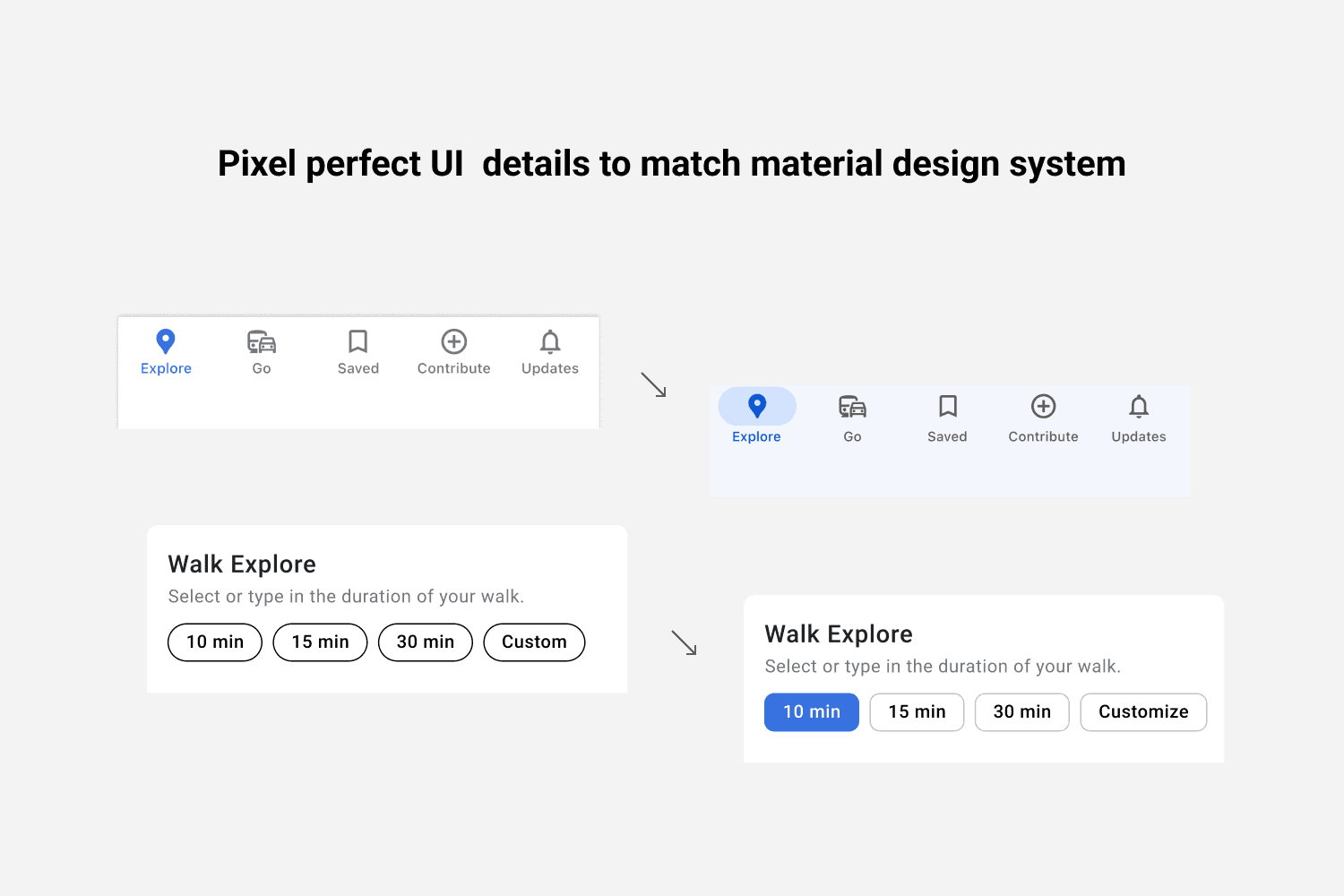
/ Feedback from users suggested that certain UI elements appeared inconsistent compared to current Google Maps designs. Therefore, we revisited and closely examined Google Maps' design principles to tweak our UI components.
04 - Final Design
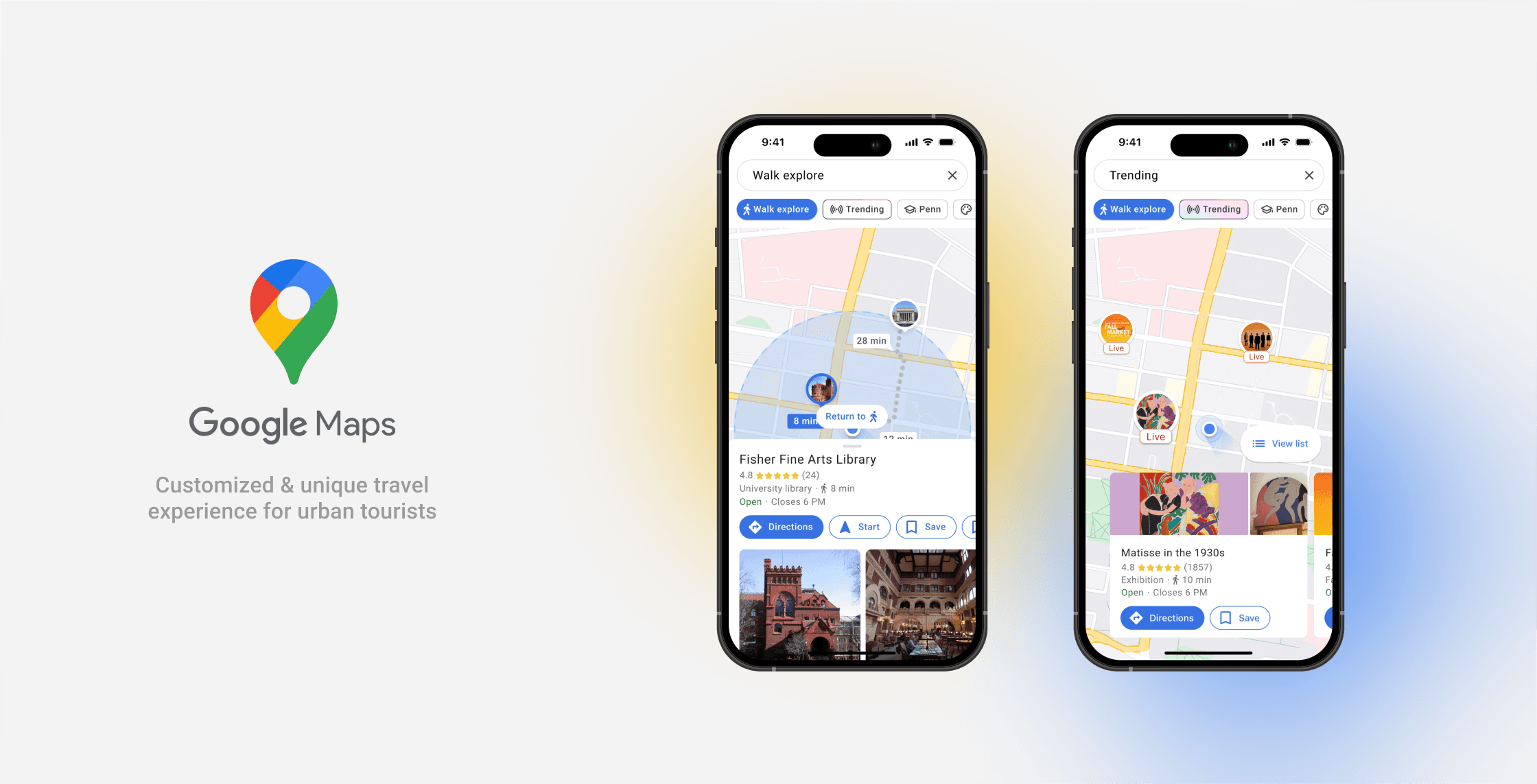
After rounds of testing and iteration, the "Walk Explore" introduced two main features for tourists and city residents to explore the city with both surprise and control.
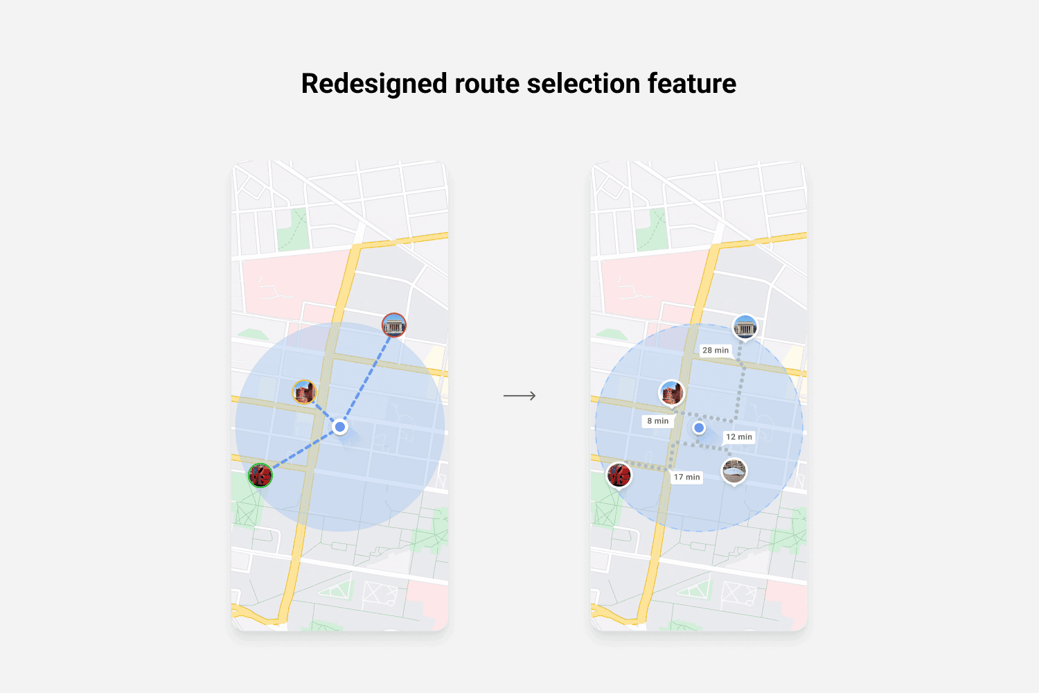
01 - Time-dependent circles for walkable attractions
We introduced a time-dependent circle to help tourists and city residents explore city attractions based on their available time frame. According to our preliminary research, users generally believe that walking is the best way to explore the city. Embracing this idea, we provided a stress- and anxiety-free solution.
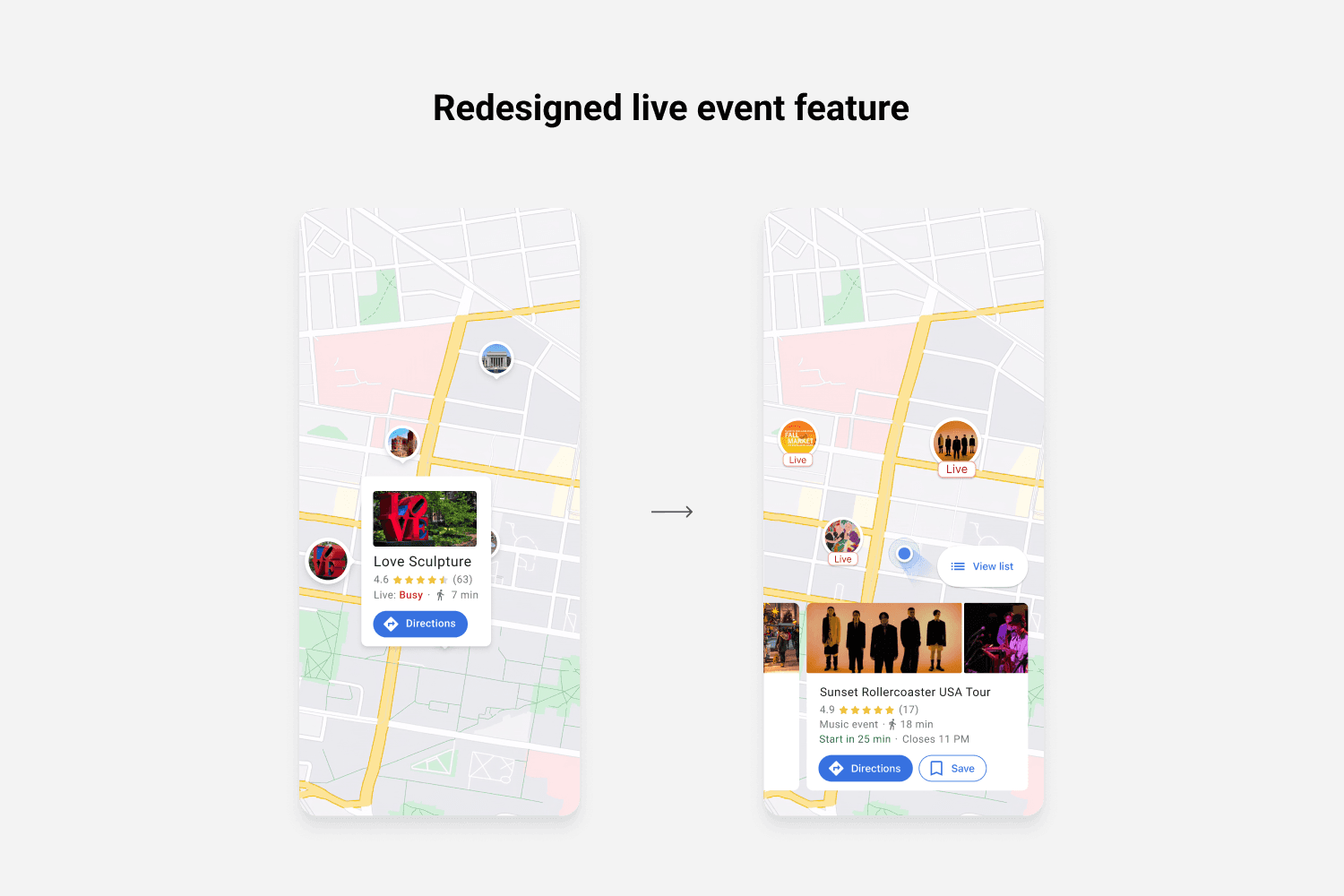
02 - Live events and exhibition for unique travel experience
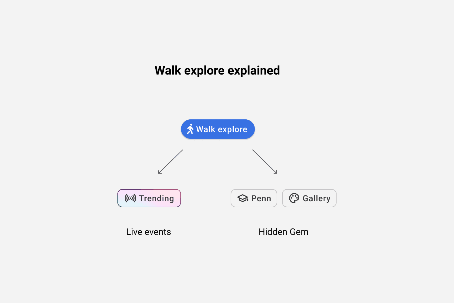
Tourists and city residents alike desire unique, once-in-a-lifetime experiences while exploring the city. Therefore, we have thoughtfully added a 'Trending' category under the 'Walk Explore' feature to provide personalized city exploration options for all users.
05 - Reflection and Next Step
Add more transport options to cover more user groups
While 58% of tourists prefer to explore the city on foot, a significant number still rely on driving, biking, or a combination of both. We didn't forget them and aim to provide an all-inclusive solution for adaptability. The most intriguing and uncharted area to explore further is how to offer a multi-transportation combination option, granting tourists more customization and control over their journeys.
Define the implemention method for all navigation apps
We began the project by selecting a navigation app, specifically Google Maps, to design the "Walk Explore" feature, as we believe navigation apps already provide a solid foundation. In the future, if "Walk Explore" proves to be useful, we aim to integrate it with other popular navigation apps like Apple Maps and Waze. Consequently, we need to determine the best solution for this integration, whether it be a plug-in option or a direct implementation.
